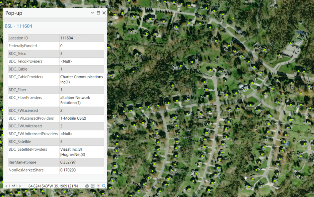
The Broadband Fabric ServiceLandscape Data delivers a comprehensive view of broadband service availability, competition, and federal funding at a granular level. Built on CostQuest’s Location Data, this Dataset includes precise geospatial service availability insights sourced from the FCC’s Broadband Data Collection (BDC) program, the industry-standard Dataset used by governments and organizations.
Broadband coverage & provider footprints at your fingertips
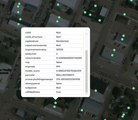
Each location record includes verified service availability by provider and technology type, competitive landscape insights for assessing broadband market density, and federal funding awards highlighting existing infrastructure investments, deployment trends, and their impact on connectivity.
Coverage & Competition
Market Insights
Data that Drives Action
Data Included
Expand the box below to see the data fields included. Click on the data category to see its description.

What can I use the data for?
Planning
Develop Broadband Service Maps
Planning
Build Network Designs

Planning
Identify Grant Opportunities Faster

Planning
Deployment Validation
Planning
Reporting Obligations – USAC HUBB

From discovery to deployment in 4 simple steps
Step 1
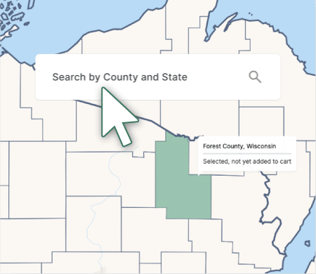
Select your geography(s) of interest on TrueVerra or Via Sales
Search by county to select the geography you need for your strategic planning and operational needs via TrueVerra Data Selection Map: https://trueverra.io/data-selection-map. Or contact our sales team for bulk geography or nationwide orders.
Step 2
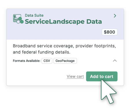
Select a Data Suite
Choose from Location, ServiceLandscape, and NetworkPlan—all the data you need is right within your orbit.
Step 3
Download and Integrate
Datasets are delivered in CSV or GeoPackage (.gpkg) formats, ready to plug into your GIS platforms, SQL, broadband models, or internal systems. If you purchase the data through our TrueVerra platform, the data is delivered instantly upon purchase. If the data is purchased through our sales team, your data will be delivered to you through them.

Step 4
Analyze. Plan. Deploy
Upon downloading the data, you can now uncover location-level insights for your areas of interest to support strategic broadband planning, financial modeling, network design, internal data processing, compliance tracking, and beyond.
Trusted by Federal Agencies, relied on by industry